
Lord of the Rings filming locations in Queenstown
Find Lord of the Rings filming locations around Queenstown, with practical self-drive routes, map links, access advice and guided tour options.
Most of the sets are long gone, but the country around Queenstown is easy to recognise: the Arrow River, Kawarau Gorge, The Remarkables and the beech forest beyond Glenorchy all played a part in Middle-earth.
Use this guide to choose the locations that suit your time, vehicle and appetite for gravel roads. Some exact filming spots are on private land, so a pin on a map does not always mean public access.
Pick your kind of day
- An easy outing: walk beside the Arrow River, then stop at the Kawarau Suspension Bridge. Both are public, straightforward to reach and work well without a 4WD.
- A booked self-drive visit: allow a few hours for Deer Park Heights. You need your own car and must reserve entry before you arrive.
- A full day towards Glenorchy: stop at Twelve Mile Delta, continue to Glenorchy and add Paradise only when the road is open and conditions suit.
- The exact locations: take a guided 4WD tour. This is the sensible choice for Skippers Canyon and for sites on private farms beyond Glenorchy.
Lord of the Rings filming locations near Queenstown
Arrow River: the Gladden Fields and Ford of Bruinen
The Arrow River appeared as the Gladden Fields, where Isildur loses the Ring. Parts of the Ford of Bruinen sequence were also filmed around Arrowtown and in Skippers Canyon.
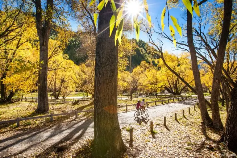
For the simplest visit, start near Dudley's Cottage and follow the Arrowtown Millennium Walk. The easy 4.2 km loop takes about an hour and passes the Gladden Fields location. Nothing was left behind after filming, so use the river, willows and surrounding hills to match the scene.
Access: Public walking track. Park in Arrowtown and go on foot.
See the official trail map and details · Open Arrowtown in Google Maps
Kawarau River: the Anduin and Argonath
The Kawarau River stood in for the Anduin. The landscape around Kawarau Gorge was used for the Fellowship's journey past the Argonath; the enormous stone kings were added later.
The easiest public viewpoint is the Kawarau Suspension Bridge. You can look along the gorge from the viewing areas without paying for an activity. Chard Farm Road gives another angle over the river, but it is narrow and serves private properties, so drive slowly and respect signs.
Access: Sealed road to the Kawarau Suspension Bridge, with visitor parking. Allow about 30 minutes from central Queenstown.
Open the Kawarau Suspension Bridge in Google Maps
Deer Park Heights: Rohan and the warg riders
Deer Park Heights, on the hill above Frankton, was used for the warg riders' attack and the flight of the people of Rohan. Several viewpoints across the Whakatipu basin appeared on screen.
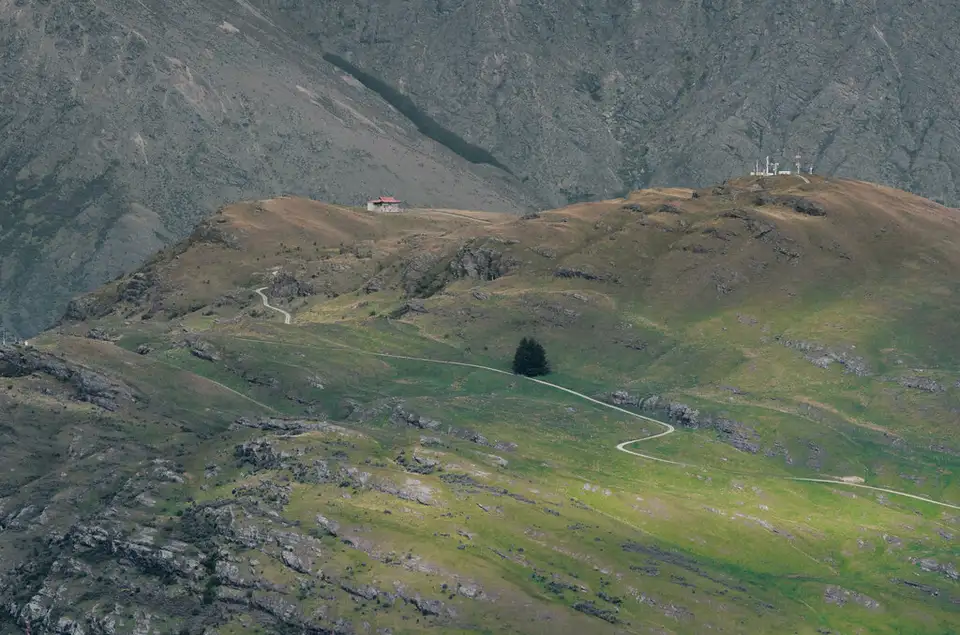
This is a private working farm. Entry is self-drive and must be booked. You need a passenger car; walking and cycling access are not allowed. Once inside, short walks lead from the drive to viewpoints and film-location signs.
Access: Book before you go and arrive in your own car. Entry numbers are limited.
Book and check current access with Deer Park Heights · Open the entrance in Google Maps
The Remarkables: Dimrill Dale
The Remarkables became the slopes of Dimrill Dale after the Fellowship escaped Moria. You do not need to reach the exact camera position to understand the choice: the range fills the eastern side of the basin and is visible from Frankton, Kelvin Heights and the road to Deer Park.
The ski area road climbs much higher, but it is an alpine road. In winter, check the ski area's road report, carry chains when required and do not stop outside marked areas.
Access: The range is visible from public roads around Frankton. Mountain access depends on weather and seasonal operations.
Open The Remarkables in Google Maps
Twelve Mile Delta: Ithilien camp
Twelve Mile Delta was Ithilien, where Frodo, Sam and Gollum watched Faramir's rangers attack the men of Harad and where Sam considered the proper use of potatoes.
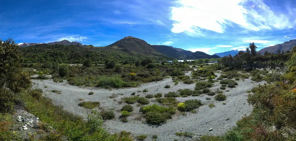
The Department of Conservation campsite is 12 km along the Glenorchy–Queenstown Road. From the western end of the camping area, the track towards Bob's Cove follows the lakeshore through native bush. The two filming points are close to the delta rather than at Bob's Cove itself.
Access: Public conservation land. The turn-off is sealed, with narrow gravel roads inside the camping area. Summer parking gets busy; use the car park and do not stop or reverse onto Glenorchy–Queenstown Road.
Read the DOC track and access notes · Open Twelve Mile Delta in Google Maps
Glenorchy, Paradise and Mount Earnslaw: Isengard and Lothlórien
The country around Glenorchy carried much of the trilogy. Mount Earnslaw appears in the opening of The Two Towers. The Dart Valley and Paradise area supplied Isengard and Lothlórien, while Closeburn was used for Amon Hen.
The road from Queenstown to Glenorchy is sealed and normally takes about 45 minutes without stops. You will stop, so allow an hour. Beyond Glenorchy, roads become narrower and sections are unsealed. The precise paddocks and forest sites are not all public; stay on formed public roads unless a tour or landowner has given access.
Paradise and nearby valleys are working-country access routes, not film sets. Gates, stock and road-closed signs have the final word.
Access: Easy sealed drive to Glenorchy. Beyond Glenorchy, check road and weather conditions before leaving and do not rely on a map app alone.
Open the Queenstown–Twelve Mile Delta–Glenorchy route in Google Maps
Skippers Canyon: the Ford of Bruinen
Skippers Canyon supplied part of the Ford of Bruinen sequence, where Arwen faced the Nazgûl. The filming location sits in steep gold-mining country behind Coronet Peak.
Skippers Road is narrow, unsealed and cut into the cliff. Many rental agreements exclude it, which may also void insurance. Slips and winter weather can close the road at short notice. This is one location where going with a local 4WD driver is worth it.
Access: Check current conditions and your rental agreement. Do not attempt the road when it is closed or excluded from your vehicle contract.
See DOC's filming-location coordinates · Find guided 4WD trips
Mavora Lakes: a longer day for committed fans
Mavora Lakes is in Southland rather than Queenstown, but it contains several closely grouped locations: Nen Hithoel, the Silverlode and Anduin rivers, the edge of Fangorn Forest and the Fellowship's route south of Rivendell.
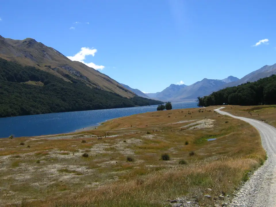
It is a long return drive and the final 39 km is gravel. There is no regular public transport. A locked gate controls vehicle access along North Mavora Lake; register with DOC for the current code if your route goes beyond the camping area.
Access: Treat this as a separate full day, carry food and fuel, download maps before leaving and check DOC alerts.
Plan a Mavora Lakes visit with DOC · Open the Queenstown–Mavora Lakes route in Google Maps
Two useful self-drive routes
Half day: river, Rohan and the Kawarau
Drive from Queenstown to Deer Park Heights for a pre-booked visit, continue to Arrowtown for the river walk, then finish at the Kawarau Suspension Bridge. If Deer Park is full, the Arrowtown and Kawarau stops still make a good short loop.
Open the half-day route in Google Maps
Full day: Ithilien to Isengard
Leave early for Twelve Mile Delta, walk the first part of the Bob's Cove track, stop at Bennett's Bluff and have lunch in Glenorchy. Add Paradise only if the road is open, the weather is settled and your vehicle agreement allows unsealed roads. A guided tour is better if the exact filming sites matter more than the drive.
Open the Glenorchy route in Google Maps
Before you set out
- Check QLDC transport and winter-road updates, especially for Glenorchy, Paradise and Skippers.
- Read your rental agreement before using any unsealed road.
- Download the route before leaving town; mobile coverage fades beyond Glenorchy and around Mavora Lakes.
- Park only in formed areas. The Glenorchy road is busy and its shoulders are narrow.
- Leave gates as you find them and keep away from stock and private buildings.
- Expect landscapes, not preserved sets. A guided tour adds scene stills, stories and access that a self-drive visit cannot.
For the wider screen story, see Queenstown film locations you can actually visit.
Photographs: Deer Park Heights and Twelve Mile Delta by Jeff Hitchcock (CC BY 2.0); North Mavora Lake by nova viator (CC BY-SA 2.0).

Nothing matches — try another word, or clear the search.


